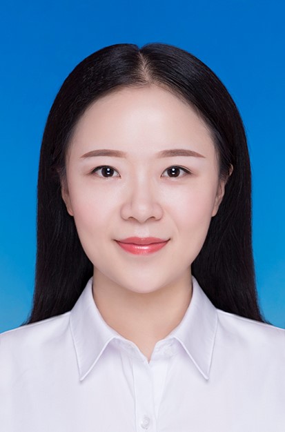
陈姗姗,女,博士。现任云南大学生态与环境学院讲师,硕士生导师,云南省“兴滇英才支持计划”青年人才,云南大学青年培优计划入选者。
主要从事城市环境遥感、热红外定量遥感、热风险暴露与健康效应方面的研究。先后承担完成了国家自然科学基金项目、国家重点研发项目、国防科工重点项目等10余项;在国内外核心刊物上发表学术论文30余篇,其中SCI刊物上发表20余篇。围绕城市环境遥感估算与应用研究,在理论基础、方法模型、产品生成与地面验证等方面积累了丰富经验,主要学术成果包括以下几个方面:
(1)提出城市地表热辐射传输物理模型(UCM-RT model),弥补了城市地表热辐射传输过程的理论基础,并针对高分五号卫星高分辨率热红外数据构建了城市地表温度新型反演方法(UTES/USW算法),实现了城市像元冠层尺度地表温度遥感反演。考虑了几何结构和邻近效应的城市地表温度在城市内部的空间异质性比传统的平坦地表温度更显著,可为城市热环境研究提供更加精细的地表温度空间分布。
(2)将热红外信息引入沙地监测,提出新型沙地监测遥感指数(SDEI),经验证在地面、机载和卫星平台具备良好适用性,将其应用于中国沙地监测,公开发布利用遥感技术获取的2000-2016年中国长时序沙地空间分布产品。在毛乌素、科尔沁等沙地的应用结果表明,SDEI对低含沙量像元的响应更敏感,更利于过渡地带沙化土地的精细化监测。该成果被遴选为IEEE TGRS封面论文。
(3)将VIIRS-NPP夜间灯光遥感数据引入人为热排放通量估算中,构建了一套可操作性较高的精细格网化人为热排放通量参数化方案,便于区域间的推广和应用,提升了人为热排放通量估算的精细化程度,并获取了长时序人为热排放通量格网化产品。该参数化方案被广泛应用于多区域多尺度的人为热排放通量的估算中。
联系方式
E-mail: sschen@ynu.edu.cn
学历
l 2011.9-2015.7:武汉理工大学地理信息系统专业学习,获理学学士学位
l 2012.9-2015.7:武汉大学英语专业学习,获文学学士学位
l 2015.9-2018.7:首都师范大学,获地图学与地理信息系统专业硕士学位
l 2018.9-2022.7:北京大学,获地图学与地理信息系统专业博士学位。
近十年主持或承担的科研项目
l 2022-2025:云南大学青年人才引进科研启动项目:城市热环境评价与健康风险研究,项目负责人,经费50万元
l 2023-2027:云南省西南联合研究生院科技专项:基于大数据的滇中城市群发展质量评估与国土空间优化研究,项目参与人,经费260万元
l 2024-2026:国家基金委青年项目:城市三维景观对热辐射的再分配过程及其热环境效应研究,项目负责人,经费30万元
l 2024-2027:云南省科技厅面上项目:闲置土地资源光伏发电与绿化的碳减排潜力评估,项目负责人,经费10万元
l 2025-2029:云南省“兴滇英才支持计划”青年人才项目:云南省光伏开发空间适宜性及碳减排效应评估,项目负责人,经费30万元
学术兼职
Remote Sensing of Environment, IEEE Transactions on Geoscience and Remote Sensing, ISPRS Journal of Photogrammetry and Remote Sensing, Science of the Total Environment, IEEE Journal of Selected Topics in Applied Earth Observations and Remote Sensing等主流SCI期刊审稿人。
获奖情况
l 2024年获高校GIS论坛“优秀GIS博士学位论文”
l 2022年获北京大学优秀博士学位论文
l 2020年获地球空间信息科学国际博士生论坛最佳口头报告奖
l 2018年获北京市优秀毕业生
l 2016年获中国地理信息科学理论与方法学术年会优秀论文奖
近十年发表主要学术论文
1. Shanshan Chen, Liding Chen, Huazhong Ren, Yingjie Li, Yijia Chen, Jinxin, Guo, Yuanheng Sun, Yitong Zheng. Quantifying adjacent thermal effects: An essential consideration in evaluating thermal effects of 3-D urban landscapes. Sustainable Cities and Society. 2025, 128:106493.
2. Shanshan Chen, Yijia Chen, Song Gao, Chun Li, Ninglv Li, Liding Chen. A modified spectral remote sensing index to map plastic greenhouses in fragmented terrains. Smart Agricultural Technology. 2025, 11:100904.
3. Shanshan Chen, Huazhong Ren, Chenchen Jiang, Yuanjian Teng, Xin Ye, Jinshun Zhu, Jiaji Dong, He Huang, Yu Liu. Urban land surface temperature retrieval from high spatial resolution thermal infrared image using a modified split-window algorithm. IEEE Transactions on Geoscience and Remote Sensing, 2023, 61:1-16.
4. Shanshan Chen, Huazhong Ren, Xin Ye, Jiaji Dong, Yitong Zheng. Geometry and adjacency effects in urban land surface temperature retrieval from high-spatial-resolution thermal infrared images. Remote Sensing of Environment. 2021, 262:112518.
5. Shanshan Chen, Huazhong Ren, Rongyuan Liu, Yunzhu Tao, Yitong Zheng, Hongcheng Liu. Mapping sandy land using the new sand differential emissivity index from thermal infrared emissivity data. IEEE Transactions on Geoscience and Remote Sensing, 2021, 59(7):5464-5478.
6. Shanshan Chen, Deyong Hu, Charles Wong, Huazhogn Ren, Shisong Cao, Chen Yu, Derrick Ho. Characterizing spatiotemporal dynamics of anthropogenic heat fluxes: A 20-year case study in Beijing–Tianjin–Hebei region in China. Environmental Pollution, 2019, 249:923-931.
7. Shanshan Chen, Deyong Hu. Parameterizing the anthropogenic heat flux with energy-consumption inventory and multi-source remote sensing data. Remote Sensing, 2017, 9(11):1165.
8. Deyong Hu, Shanshan Chen, Kun Qiao, Shisong Cao. Integrating CART Algorithm and Multi-source Remote Sensing Data to Estimate Sub-pixel Impervious Surface Coverage: A Case Study from Beijing Municipality, China. Chinese Geographical Science, 2017, 27(4):614-625.
9. Shanshan Chen, Huazhong Ren, Yunzhu Tao, Yitong Zheng, Yuanheng Sun, Jing Nie, Jinxin Guo, Rongyuan Liu, Wenjie Fan. A new index for sandy land detection based on thermal infrared emissivity data.IEEE International Symposium on Geoscience and Remote Sensing IGARSS. 2019, 8900204:1402-1405.
10. Yijia Chen, Shanshan Chen, Song Gao, Chun Li, Ninglv Li, Liding Chen. A modified spectral remote sensing index to detect spatiotemporal changes of plastic greenhouses in fragmented terrains. IEEE International Symposium on Geoscience and Remote Sensing IGARSS. 2024, 10690359:9311-9314.
11. Deyong Hu, Shanshan Chen, Fuzhou Duan. Estimation of the anthropogenic heat flux distribution in Beijing-Tianjin-Hebei region based on Suomi-NPP/VIIRS nighttime light image. IEEE International Symposium on Geoscience and Remote Sensing IGARSS. 2017, 8127880:4012-4015.
12. 周思菡, 陈姗姗, 杨静, 李颍杰, 陈利顶. 双碳目标下云南省光伏项目建设现状与发展分析. 太阳能. 2026.
讲授课程
《GIS与遥感基础》《遥感大模型原理与应用》《AI+数据分析与建模》等。
其他(如招生要求等)
招生专业:生态学(071300)、遥感科学与技术(140400)、资源与环境(085700)。欢迎联系报考,有地理学、遥感科学、景观生态学、大气科学背景的同学优先考虑。